Map Support for SUSI Webchat
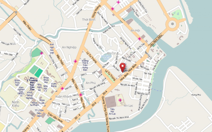
SUSI chat client supports map tiles now for queries related to location. SUSI responds with an interactive internal map tile with the location pointed by a marker. It also provides you with a link to open street maps where you can get the whole view of the location using the zooming options provided and also gives the population count for that location.
Lets visit SUSI WebChat and try it out.
Query : Where is london
Response :
- City of London is a place with a population of 7556900. Here is a map:https://www.openstreetmap.org/#map=13/51.51279067225417/-0.09184009399817228
- Link to Openstreetmap: City of London (Hyperlinked with https://www.openstreetmap.org/#map=13/51.51279067225417/-0.09184009399817228)
- <Map Tile>

Implementation:
How do we know that a map tile is to be rendered?
The actions in the API response tell the client what to render. The client loops through the actions array and renders the response for each action accordingly.
"actions": [
  {
    "type": "answer",
    "expression": "City of London is a place with a population of 7556900.             Here is a map: https://www.openstreetmap.org/#map=13/51.51279067225417/-0.09184009399817228"
  },
  {
    "type": "anchor",
    "link":    "https://www.openstreetmap.org/#map=13/51.51279067225417/-0.09184009399817228",
    "text": "Link to Openstreetmap: City of London"
  },
  {
    "type": "map",
    "latitude": "51.51279067225417",
    "longitude": "-0.09184009399817228",
    "zoom": "13"
  }
]
Note: The API response has been trimmed to show only the relevant content.
The first action element is of type answer so the client renders the text response, ‘City of London is a place with a population of 7556900. Here is a map: https://www.openstreetmap.org/#map=13/51.51279067225417/-0.09184009399817228’
The second action element is of type anchor with the text to display and the link to hyperlink specified by the text and link attributes, so the client renders the text `Link to Openstreetmap: City of London`, hyperlinked to “https://www.openstreetmap.org/#map=13/51.51279067225417/-0.09184009399817228”.
Finally, the third action element is of type map. Latitude, Longitude and zoom level information are also specified using latitude, longitude and zoom attributes. The client renders a map using these attributes.
I used ‘react-leaflet’ module to render the interactive map tiles.
To integrate it into our project and set the required style for the map tiles, we need to load Leaflet’s CSS style sheet and we also need to include height and width for the map component.
<link rel="stylesheet" href="http://cdn.leafletjs.com/leaflet/v0.7.7/leaflet.css" />
.leaflet-container {
  height: 150px;
  width: 80%;
  margin: 0 auto;
}
case 'map': {

  let lat = parseFloat(data.answers[0].actions[index].latitude);
  let lng = parseFloat(data.answers[0].actions[index].longitude);
  let zoom = parseFloat(data.answers[0].actions[index].zoom);
  let mymap = drawMap(lat,lng,zoom);

  listItems.push(
    <li className='message-list-item' key={action+index}>
      <section className={messageContainerClasses}>
        {mymap}
        <p className='message-time'>
          {message.date.toLocaleTimeString()}
        </p>;
      </section>
    </li>
  );

  break;
}
import { divIcon } from 'leaflet';
import { Map, Marker, Popup, TileLayer } from 'react-leaflet';


// Draw a Map

function drawMap(lat,lng,zoom){

  let position = [lat, lng];

  const icon = divIcon({
    className: 'map-marker-icon',
    iconSize: [35, 35]
    });

  const map = (
    <Map center={position} zoom={zoom}>
      <TileLayer
      attribution=''
      url='http://{s}.tile.osm.org/{z}/{x}/{y}.png'
      />
      <ExtendedMarker position={position} icon={icon}>
        <Popup>
          <span><strong>Hello!</strong> <br/> I am here.</span>
        </Popup>
      </ExtendedMarker>
    </Map>
  );

return map;

}
Here, I used a custom marker icon because the default icon provided by leaflet had an issue and was not being rendered. I used divIcon from leaflet to create a custom map marker icon.
When the map tile is rendered, we see a Popup message at the marker. The extended marker class is used to keep the Popup open initially.
class ExtendedMarker extends Marker {
  componentDidMount() {
    super.componentDidMount();
    this.leafletElement.openPopup();
  }
}
The function drawMap returns a Map tile component which is rendered and we have our interactive map!


You must be logged in to post a comment.